WELCOME TO SABUR, INC.
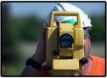
 At Sabur, Inc., it is our mission to provide accurate professional land surveying services that are timely and complete the project objectives of our clients.more about us...
Sabur typically provides Boundary Surveys and Topographic Surveys or Right-of-Way Surveys for their use in designing roadways, municipal sewer projects, bridges, commercial developments, bike trails, levees, and many more improvements.
 Sabur prepares Preliminary Plans for your development ideas or we create the base plan for you to develop your own site plan. Data provided by Sabur may include FEMA Flood Data, USGS maps, Recorded Subdivision Plats, and Property Deeds. Part of Preliminary Plan preparation includes deed plotting, utility, and sewer research. Other information Sabur can acquire and provide may include: GLO plats, raw field data made available in AutoCAD, property descriptions, deed plots, easement exhibits and script for agreements between property owners, elevation certificates, letter of map revision (LOMR), and letter of map amendment (LOMA).


Sabur prepares Plot Plans as is often required by the governing municipality or county that shows where you will be building an addition to your house, garage, pool, or deck.
The survey of multiple lots in a neighborhood, commercial or residential, can result in fees that are much less than for one owner when grouped together with other lot owners. Moreover the resulting survey may be more accurate simply because more and better evidence may be made available to the surveyor when resolving the boundaries.

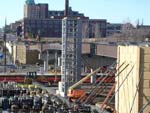
Grand Avenue Viaduct - BPS
Location: City Of St. Louis, I-64 & Grand Ave.
Project Design/Construction Cost: $25 Million Dollars
Project Design Team Surveyor: Sabur, Inc.
Check out more of our projects on our portfolio page.


