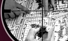
- Strip Maps for Municipal Storm and Wastewater Projects
- Construction Stakeout
- GPS surveys
- ALTA/ACSM surveys
- Right-of-way & Boundary Surveys
- Topographic Surveys
- Large Scale utility mapping (GIS)
- Record plats-Boundary Adjustment
Plats-Right-of-Way Dedication Plats - Easement Exhibits
- Legal descriptions for title purposes and recording
- Aerial survey (ground) control
ŌĆō aerial surveys
SABUR PROVIDES SERVICES TO ALL INDUSTRIES AND LAND OWNERS:
For Engineers and Architects: We typically provide Boundary Surveys and Topographic Surveys or Right-of-Way Surveys for their use in designing roadways, municipal sewer projects, bridges, commercial developments, bike trails, levees, and many more improvements.
SABUR ASSEMBLES DATA FOR YOUR USE AND PROVIDES OTHER SERVICES AS STATED:
Sabur prepares Preliminary Plans for your development ideas or we create the base plan for you to develop your own site plan. Data provided by Sabur may include FEMA Flood Data, USGS maps, Recorded Subdivision Plats, and Property Deeds. Part of Preliminary Plan preparation includes deed plotting, utility, and sewer research. Other information Sabur can acquire and provide may include: GLO plats, raw field data made available in AutoCAD, property descriptions, deed plots, easement exhibits and script for agreements between property owners, elevation certificates, letter of map revision (LOMR), and letter of map amendment (LOMA).
Sabur prepares Plot Plans as is often required by the governing municipality or county that shows where you will be building an addition to your house, garage, pool, or deck.
SABUR MULTI-LOT SURVEY PROGRAM (MLSP)
The survey of multiple lots in a neighborhood, commercial or residential, can result in fees that are much less than for one owner when grouped together with other lot owners. Moreover the resulting survey may be more accurate simply because more and better evidence may be made available to the surveyor when resolving the boundaries.
Additional services not typically provided by land surveyors but may be utilized are: a maintenance program to keep your survey up-to-date.
- Its features may include:
- Maintaining on a yearly basis the corner monuments
- Showing traverse data on the survey and/or (3) point ties at property corners for ease in locating them
- A report which explains what evidence was found, set, and held in the resolving of your property boundaries including the documents relied upon in that resolution
- An electronic version of the survey which can be delivered in Portable Document Format (.pdf), AutoCAD (.dwg), and AutoCAD (.dwf) which can be read with a program available for use as a reader to AutoCAD and may be downloaded through ŌĆ£Free Autodesk Design ReviewŌĆØ


